
Trails Blend Health and History
Trails Blend Health and History
By Thomas P. Caldwell
Outdoor recreation remains among the healthiest activities to pursue, and one of the best offerings in the Lakes Region is the series of walking, hiking, and biking trails that are being developed alongside the lakes and rivers, many of them utilizing old railroad beds.

Landscaping for Bristol Falls Park, built on the site of a former railroad station, was completed on July 23, the first part of a trails project slated to create a multi-use path along the Pemigewasset River extending to Profile Falls. (Tom Caldwell Photo)
The latest development is Bristol Falls Park, located at a former railroad branch station at the confluence of the Newfound and Pemigewasset rivers. The park, completed on July 23, will serve as the stepping-off point of the Pemi Trail, proposed to connect downtown Bristol with Profile Falls in the Franklin Flood Control Area.
Today, that trail consists of a path that largely follows the old railroad bed that served the Bristol Branch, coming out of Franklin. Plans call for a phased approach involving the construction of a bridge over a washed-out area and widening the overgrown path with a hard-packed surface suitable for bicycles as well as pedestrians.
The town has discussed such a trail with the U.S. Army Corps of Engineers for the last three decades, but the effort picked up support in 2018, when Bristol entered into a partnership with the University of New Hampshire Cooperative Extension as part of the Community & Economic Development team’s new Downtown & Trails Pilot Program. The UNH Extension has been providing assistance in the exploration of action that could leverage the area’s natural assets for economic vibrancy, according to Bristol Town Administrator Nik Coates.
“The project had been envisioned many years, including being brought to the fore when the design charrette was done which was also the spark for the redevelopment of [Central] Square,” Nik said.
Multi-use trails have proven to be economic drivers, bringing walkers and bicyclists — and snowmobilers in the winter months — to the stores and restaurants lying near the paths. The Northern Rail Trail, for instance, which runs from Boscawen to Lebanon, spurred a revitalization that included businesses in downtown Danbury, situated at the halfway mark.

An old photograph shows the former Bristol Railroad station at the confluence of the Newfound and Pemigewasset rivers in Bristol where a new town park now exists. (Courtesy Bristol Historical Society)
The Winnipesaukee River Trail, built along another railroad bed, extends from Prospect Street in Franklin to Park Street in Northfield, with another section running from the Tilton Police Station to Route 140, for a total distance of 4.2 miles. The first section of the trail, from downtown Franklin to the “upside-down” sulphite railroad bridge, is paved, after which it has a packed dirt surface. The section from Franklin to Cross Mill Road in Northfield largely follows the Winnipesaukee River, known for its Class IV rapids popular with kayakers. From Cross Mill to Park Street, the trail veers away from the river but passes two ponds that boast abundant wildlife. The trail ends at the Northfield Freight Depot. From there, users need to travel along sidewalks on Elm Street in Northfield and cross into Tilton on Cannon Bridge, then use the sidewalks from downtown Tilton to the Tilton Police Station parking area, where the trail resumes.
The Winni Trail passes mill ruins that are highlighted on informational signs placed along the path to highlight the history of the area. That is something Bristol plans to do with its new park and trail system.
Bristol already has a multi-use trail on its north end, extending from Mill Stream Park to Newfound Lake. Part of the trail lies across the Newfound River, but most of it runs alongside Lake Street and, at one point, requires crossing the road.
The new park, Nik says, is a beautiful spot that showcases nature while being just a short distance from downtown Bristol.
Building a Park
All that remained of Bristol’s former train depot were the ruins, with stone foundations and remains of a bridge. In order to create Bristol Falls Park, the town had to bring in tons of dirt and rock to even out the terrain, and build a new bridge over the Newfound River. Except for the bridge, which required hiring an outside firm, the majority of the work was done by town staff.
A grant from the New Hampshire Water Conservation Fund covered part of the cost of the project, Nik said, adding that the town hopes to obtain a similar grant to extend the trail 2.5 miles to Profile Falls. In order to formally apply for the grant, however, the town needs a permit from the Army Corps of Engineers, which oversees the Franklin Flood Control Area.
Nik credits Senator Jeanne Shaheen’s office for helping to get the ball rolling. The town had been having conversations with the Corps of Engineers since 1987, but after Shaheen got involved in March or April and agreed that the trail would create “the economic resilience we need,” Army officials expressed support for a memorandum of understanding that would allow the project to move forward.
“Once we have an MOU in hand, we can apply for grants,” Nik said, noting that the major expense in completing the trail is building a bridge over the eroded “canyon” that lies along the first portion of the trail. That bridge, he estimated, will cost $360,000, and the total cost for the trail is estimated to be about $1 million.
Once the trail reaches the area of Profile Falls, users will be able to continue through Old Hill Village to Franklin. Formerly the main route between Bristol and Franklin, that section of road was abandoned when the building of the flood control dam forced the town of Hill to relocate on higher ground — the state’s first project overseen by what would become the Office of State Planning. Today, the old road to Hill and Franklin is used by bicyclists, walkers, and pet owners who can explore the many side trails, fields, and wooded areas, as well as enjoying the Pemigewasset River as it flows toward Franklin and joins the Winnipesaukee River to form the Merrimack.
On the other side of the Pemi, off Route 127, the Franklin Flood Control Area boasts 10 miles of multi-use trails. Local Boy Scouts also cleared an area that was to become part of the Heritage Trail between New Hampton and Franklin.
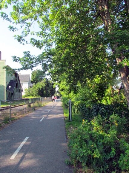
The Winnisquam-Opechee-Winnipesaukee Trail cuts through downtown Laconia and extends to Lakeport, with plans to expand to The Weirs. (Tom Caldwell Photo)
Also in New Hampton, the town created an .89-mile nature-fitness loop behind the police and fire department building with river overlooks and exercise stations. When dedicating the trail, then-Selectman (now Town Administrator) Neil Irvine said it resulted from “a collective awareness of how important it is to have recreation in our lives.”
Other Trail Systems
Beyond Tilton’s terminus of the Winnipesaukee River Trail is another multi-use trail, the Winnipesaukee Scenic Trail in Belmont which skirts Lake Winnisquam. It begins by the Winnisquam Agway store and continues to the Laconia town line, offering occasional glimpses of deer, foxes, beavers, and birds, including bald eagles. There also is an osprey nest at Ephraim’s Cove.
At the Laconia town line, the trail becomes the Winnisquam-Opechee-Winnipesaukee (WOW) Trail, continuing through downtown Laconia to Lakeport.
The WOW Trail grew out of the desire of the late Fred Toll, a Laconia City Councilor known for his support of recreation, to make use of the little-used railroad corridor. Toll initiated the Laconia Rails with Trails Exploratory Committee which grew into the WOW Trail Committee which oversaw the first section of the trail system, covering 1.3 miles, from downtown Laconia to Lakeport Square. The second phase extended the trail westward to Belmont, and the committee is now looking to extend the trail in the other direction, to Weirs Beach. Eventually, the trail may extend to Meredith, for a total distance of nine miles.
Meredith has its own set of seven trails for walking, hiking, and pets. The 4.5-mile Hamlin Trail lies in the Hamlin Conservation Area; Waukewan Highlands is a 1.7-mile trail in Waukewan Highlands Community Park; Page Pond and Forest has 3.3 miles of trails; the Stonedam Island Long Loop Trail extends 1.8 miles; Ladd Mountain Trail is 1.5 miles long; Stonedam Island Main Loop Trail is 0.8 mile long; and there are several short trails in Swasey Park.
These are but some of the hiking and biking trails one can find in the Lakes Region, an area that has always recognized the importance of outdoor activities. It is part of what makes the region such a popular place to live or visit.